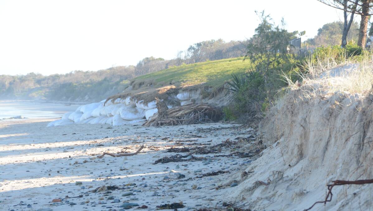
It’s a big year for how we manage our dynamic and fluctuating coastlines, both state-wide and regionally. And despite questions still hanging over the status of Boomerang and Blueys beaches and continuing unresolved issues at Old Bar and Manning Point, local plans are moving ahead.
Subscribe now for unlimited access.
or signup to continue reading
At a meeting held late last month between the NSW Office of Environment and Planning and MidCoast Council engineers from both Taree and the Great Lakes, a significant moment emerged for the region’s coastline.

"Tasks were clarified for both of the plans from the former councils. A future meeting will be held to concentrate on providing an adaptive management framework for the area from Old Bar to Manning Point. This area is likely to be dealt with separately due to the active erosion issues of this area,” MidCoast Council Investigations Engineer, Geoff Love said, confirming a new separate approach for the two northern beaches.
After four attempts since 2008 to have its plan certified by the government, Taree will now remove ‘erosion hot spots’ Old Bar and Manning Point from its Coastal Zone Management Plan to push ahead for the rest of the region.
As for the Great Lakes, its plan for coastal management to either ‘accept’ or ‘protect’ areas over the next five to 10 years is purportedly ready to “be certified”, although over it hovers the suggestion council should take another look at the status of Boomerang and Blueys beaches. Both sit within the current Local Environmental Plan 2014 as a potential hazard of climate change, incurring substantial development implications.
“[In 2011] council engaged a consultant to do desktop study on Boomerang and Blueys, and when they did they produced a report with identified dangers. Council modified its LEP to account for that as they believed they had a responsibility to respond. The problem with it, is that the study wasn’t as good as it could have been. But you get what you paid for,” Angus Gordon, Coastal specialist and former chair of the government’s advisory NSW Coastal Council said.
“What they missed out on doing, a common misunderstanding at the time, was to put in another step,” he said, adding that the hazard depends on how it’s actually managed.
“It’s important to talk about different options before jumping in and putting it straight into an LEP… But it was based on the best information available at the time.”
He said the case for further study of Boomerang and Blueys’ was merited and “to the best of my understanding the council officers think it is too.”
It will no doubt be a decision anxiously awaited by Boomerang resident and regional coordinator of the NSW Coastal Alliance Michael Fox, who has argued against the beaches’ status since they were formally red flagged in the LEP 2014.
“It’s really a simple story about the interface between land and water,” Mr Fox said.
Mr Fox’s comments come off the back of NSW Parliament’s approval of the the Coastal Management Bill 2016 in early June. The Bill provides the dry bones for a three tiered process of coastal reform, for which the main aim is to combine, overhaul and strategise policies made on the run since 1979. After all, coastal science has gone a long way since then.
The practical details lie in tier two – the Coastal Management State Environmental Planning Policy (SEPP) draft. Plow through and you’ll find the practical targets of coastal management, which will be ultimately followed by a manual ‘how-to’ guide on how achieve those targets. Details of the SEPP will go on display for comments within the next few months and splits the coast into four zones– Wetlands and Littoral Rainforests; Vulnerability; Environment; Coastal Use. For the first time, estuaries and linked waterways will be considered with coastal beaches under the one legislative umbrella. The all important ‘fluid’ zoning maps will accompany the SEPP.
“They will cause a complete riot,” said Mr Fox, concerned that the maps hadn’t yet been released.
He said since he found himself within a zoned ‘coastal hazard’ following the disputed findings of two reports commissioned by the former Great Lakes Council in 2011 and 2013 (which considered wave run up, erosion and recession), property values in the area have fallen by 30 per cent and council rates have risen.
With council adhering to the recommended global sea level rise predictions of half a metre by 2060 and 90cm by 2100, a heightened severity of floods and coastal erosion in years to come have been forecast. But both Mr Fox and Mr Gordon draw the distinction between projections and predictions, and even council’s CZMP refers to changing figures which won’t affect the current five to 10 year plan.
Sitting in between established headlands, both developed beaches are classed as “open coast beaches backed by urban development with erosion, recession and wave run-up”. But they are also classed as ‘leaky compartments’ within the new modern term trending in coastal science circles: sediment compartments.
“The Coastal Management Bill 2016 is world leading in that it is only known piece of legislation globally which enshrines our scientific understanding of the natural systems of sediment compartments which maintain beaches,” Minister for Planning Rob Stokes said.
The term is about the flow of sand on and off beaches, understanding how a sediment compartment works within itself and with others (the flow-on effect on beaches further away). The data is considered to be fundamental in adopting correct coastal management policies.
Certainly, MidCoast Council (Taree)’s senior leader for Planning and Environment Services Richard Pamplin said that figuring out why the sand was disappearing at Old Bar and Manning Point at an unforeseen rate of 40 metres over 20 years would help council incorporate the right management measures for the future.
Because at the other end of the scale are declared erosion ‘hot spots’ Old Bar, Manning Point and Jimmy’s Beach. A road reserve is well under water and one resident just lost his third building from a demolition order after the storm on June 5. The storm also battered the privately built sandbag wall in front of the Meridium Resort and surrounding land, moving sandbags weighing from 10 to 20 tonnes each.
“It held up fairly well, but we lost another four metres of sand on either side of the wall,” said Mr Pamplin, who has been keeping his eye on the wall to see how it fares. But he is not the only one watching.
“Unless seawalls are construction in coordination with all affected landowners, you can actually cause a situation where erosion is exacerbated at either end of the seawall, damaging adjacent properties.There needs to be coordination of effort,” said a spokesperson for the Minister for Planning, Rob Stokes.
Manly Hydraulics is currently studying Old Bar to better understand what’s happening under the water. All eyes are turned towards its findings. In the meantime the uncertainty of Old Bar and Manning Point has just contributed to the government’s refusal to certify Taree’s plan as it currently stands.
“They said, if you take out Manning Point and Old Bar from the plan, they could certify the plan for the rest of it,” he said, referring to 50kms of Manning coastline.
The catch of course is that without certification, council cannot access coastal funding for Old Bar and Manning Point – the areas which need it most.
As for Boomerang and Blueys, MidCoast Council would neither confirm nor deny it would reassess the beaches’ status, but coastal expert Angus Gordon said it made sense to get the CZMP and SEPP maps through first to provide a “robust mechanism” through which to argue for change to the biggest obstacle – the LEP.

